מפרץ ולורה
מראה
| מידע נוסף | |
|---|---|
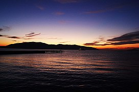
מפרץ ולורה (באלבנית: Gjiri i Vlorës) הוא מפרץ בים האדריאטי באלבניה.[1] האזור מסווג כאזור עופות חשוב (אנ') וכאזור צמחים חשוב (אנ').[2][3]
היסטוריה
בעת העתיקה (לפני 400 לפני הספירה), הגבול הצפוני ביותר של השלטון הצ'אוני (אנ') היה ממוקם בקצה הצפוני של מפרץ ולורה.[4]
בתקופת רומא העתיקה, האזור היה מקום משמעותי והיו בו מספר קרבות בניהולו של יוליוס קיסר.[5]
בתקופת המלחמה הקרה, היה באזור המפרץ בסיס ימי סובייטי.
גלריה
|
לקריאה נוספת
- Bejko, Lorenc; Morris, Sarah; Papadopoulos, John; Schepartz, Lynne (2015). The Excavation of the Prehistoric Burial Tumulus at Lofkend, Albania. ISD LLC. ISBN 1938770528.
- De Simone, Carlo (2017). "Illyrian". In Klein, Jared; Joseph, Brian; Fritz, Matthias (eds.). Handbook of Comparative and Historical Indo-European Linguistics (באנגלית). Vol. 3. Walter de Gruyter. pp. 1867–1872. ISBN 978-3-11-054243-1.
- Hammond, N.G.L. (1997). "Hammond The Tribal Systems of Epirus and Neighbouring Areas down to 400 B.C.". Epirus, 4000 Years of Greek History and Civilization.
- Hatzopoulos, M. B. (1997). "The Borders of Hellenism in Epirus during Antiquity". In M. V. Sakellariou (ed.). Ηπειρος: 4000 χρόνια ελληνικής ιστορίας και πολιτισμού. Ekdotike Athenon. ISBN 9789602133712.
- Longhurst, Ian (2016). Caesar's Crossing of the Adriatic Countered by a Winter Blockade During the Roman Civil War. The Mariner's Mirror. Vol. 102. Routledge. pp. 132–152. doi:10.1080/00253359.2015.1054681.
קישורים חיצוניים
הערות שוליים
- ↑ "Management Plan for National Marine Park Karaburun-Sazan" (PDF). mcpa.iwlearn.org (באנגלית). p. 10. ארכיון מ-2021-03-19. נבדק ב-2021-11-27.
- ↑ BirdLife International. "Vlora Bay, Karaburun Peninsula and Cika mountain". datazone.birdlife.org (באנגלית). p. 1. ארכיון מ-2018-06-12. נבדק ב-2021-11-27.
- ↑ IUCN, World Wide Fund for Nature, Plantlife. "Important Plant Areas of the south and east Mediterranean region" (PDF). portals.iucn.org (באנגלית). p. 75. ארכיון (PDF) מ-2017-06-06. נבדק ב-2021-11-27.
{{cite web}}: תחזוקה - ציטוט: multiple names: authors list (link) - ↑ Hammond 1997, p. 55: "Chaonian power thus ran from the northern end of the Gulf of Aulon (adjacent to Apollonia) to the southern end of the plain by Konispolis"
- ↑ Longhurst 2016, p. 132: "The most significant problem is the identification of Caesar’s landing place for his army with Palaeste, when it can be shown that he probably landed inside the Gulf of Valona." 134: "Pompey’s army was dispersed in winter quarters leaving his main supply base of Dyrrachium (Durazzo or Durrës) potentially vulnerable to a surprise attack. Caesar planned to land his army on the coast of Illyricum (Albania), as near as he could to Dyrrachium, march on the city and seize Pompey’s supplies."
מפרץ ולורה32683346Q999082


